
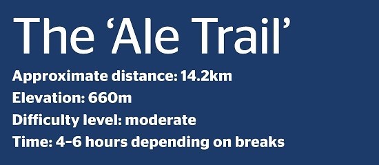
Hidden gem hike of the week : The ‘Ale Trail’
By Zane Wolfang, Jordan News

- +
- -
I decided, with some friends, to start off 2022 with a New
Year’s Day hike, and since then, we have been trying to hike on weekly basis.
I wrote what I hope to be the first of a series of “hidden gem hikes” for those who, like me, wish to explore all the pastoral beauty Jordan has to offer. I am grateful to my friends Yazeed and Yaman for inviting me to hike with them, and for generously sharing their knowledge of Jordan’s paths.اضافة اعلان
On New Year’s Day, we did a relatively easy and unremarkable hike from the Catholic Church in Rumaymin to Al-Ahliyya University, but last week, we did a really excellent one from Iraq Al-Amir to Fuheis.
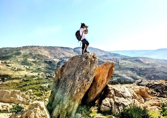
(Photo: Zane Wolfang/Jordan News)
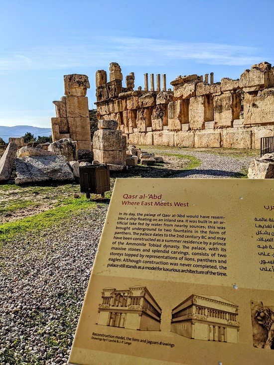
We call this route “The Ale Trail” because you can either start or end at the Carakale Brewery and tasting room in Fuheis. We started at Iraq Al-Ameer’s beautiful and underappreciated ruin called Qasr Al-Abd, which is a Hellenistic palace from the first quarter of the second century BCE. It is well-preserved, nestled in the beautiful natural surroundings of Wadi Seer, which is quite verdant and green during this time of the year. We were the only people there, besides the guard, who was very nice.
The ruins form the bottom of Iraq al-Ameer, just south of the main town. From there, we climbed a short but steep hill to the trailhead (coming from the ruins, a steep upward left at Old Palace restaurant) and then hiked back to Fuheis, gradually climbing about 660 meters along the mostly paved way, and finished our hike at Carakale. We then made our way back to Iraq Al-Amir to pick up the second car.
(Photo: Zane Wolfang/Jordan News)
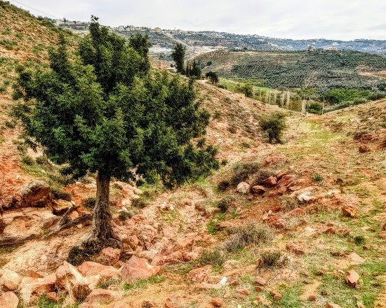
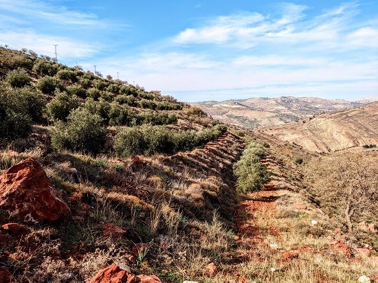
We chose to leave one car in Fuheis and drive a second car to Iraq Al-Amir to start there, but if I were to do this hike again, I might consider doing it in reverse. While I acknowledge a certain satisfaction derived from finishing a long hike with a triumphant walk directly into the bar at Carakale, I think doing it in reverse would be easier and would result in a more beautiful sequence of uninterrupted natural scenery. The very last section leading up to Carakale is home to both a landfill and a sewage treatment plant and thus is not the most spectacular view to finish on. The rest of the hike is beautiful, varying between rugged natural wadi landscapes and farming villages with lush, well-cultivated lands.
(Photo: Zane Wolfang/Jordan News)
If you were to instead leave one car near Qasr al-Abd and start your hike near Carakale, you would get the less scenic piece out of the way first, you would be going downhill for almost the entire way, you would finish at a lovely view looking over Iraq al-Amir, and you could then descend into Wadi Seer to check out the ruins. At that point, you would have to drive back to Fuheis to get your second vehicle anyway, so you could still check out the Carakale tasting room if you wanted to.
This hike is part of the Jordan Trail network, so most of its key junctures are marked with its characteristic red and white symbol. On the Jordan Trail app, it would form a section of the Salt to Iraq Al-Amir section, but for a more specific map I advise downloading Wikiloc, a free app with trails posted by users from around the world. This particular route, posted by user ludovicasocci, is titled “Iraq-Al-Amir to Carakale brewery”. You can download the map for offline use, although I had internet coverage throughout the hike.
The trail is not difficult from a technical standpoint, but it is long and at times quite steep. You need to be physically fit to complete it; it is less difficult than climbing a mountain, but much more strenuous than a casual walk. It can be done in sneakers, although hiking boots are always better, and I advise bringing a backpack and dressing in layers, particularly if you plan to finish in Fuheis in the late afternoon; you will be hot during the day while you walk, but the temperature will drop quickly as the sun goes down, particularly at the higher elevation.
(Photo: Zane Wolfang/Jordan News)
I hydrated well the night before and the morning of the hike, and still finished all of the water in my 36-ounce Yeti rambler by the time we were about ¾ of the way done.
We did pass many villages along the way, as well as the Talal al Balut Park outside of Mahas. We did not stop, but the Jordan Trail app indicates that you can stop at the park or at houses along the way to get cold drinks.
The park is probably a more helpful refill station if you are starting in Fuheis, as it is not terribly far from Iraq al-Amir.
Read more Around Jordan
I wrote what I hope to be the first of a series of “hidden gem hikes” for those who, like me, wish to explore all the pastoral beauty Jordan has to offer. I am grateful to my friends Yazeed and Yaman for inviting me to hike with them, and for generously sharing their knowledge of Jordan’s paths.
On New Year’s Day, we did a relatively easy and unremarkable hike from the Catholic Church in Rumaymin to Al-Ahliyya University, but last week, we did a really excellent one from Iraq Al-Amir to Fuheis.
(Photo: Zane Wolfang/Jordan News)
We call this route “The Ale Trail” because you can either start or end at the Carakale Brewery and tasting room in Fuheis. We started at Iraq Al-Ameer’s beautiful and underappreciated ruin called Qasr Al-Abd, which is a Hellenistic palace from the first quarter of the second century BCE. It is well-preserved, nestled in the beautiful natural surroundings of Wadi Seer, which is quite verdant and green during this time of the year. We were the only people there, besides the guard, who was very nice.
The ruins form the bottom of Iraq al-Ameer, just south of the main town. From there, we climbed a short but steep hill to the trailhead (coming from the ruins, a steep upward left at Old Palace restaurant) and then hiked back to Fuheis, gradually climbing about 660 meters along the mostly paved way, and finished our hike at Carakale. We then made our way back to Iraq Al-Amir to pick up the second car.
(Photo: Zane Wolfang/Jordan News)
We chose to leave one car in Fuheis and drive a second car to Iraq Al-Amir to start there, but if I were to do this hike again, I might consider doing it in reverse. While I acknowledge a certain satisfaction derived from finishing a long hike with a triumphant walk directly into the bar at Carakale, I think doing it in reverse would be easier and would result in a more beautiful sequence of uninterrupted natural scenery. The very last section leading up to Carakale is home to both a landfill and a sewage treatment plant and thus is not the most spectacular view to finish on. The rest of the hike is beautiful, varying between rugged natural wadi landscapes and farming villages with lush, well-cultivated lands.
(Photo: Zane Wolfang/Jordan News)
If you were to instead leave one car near Qasr al-Abd and start your hike near Carakale, you would get the less scenic piece out of the way first, you would be going downhill for almost the entire way, you would finish at a lovely view looking over Iraq al-Amir, and you could then descend into Wadi Seer to check out the ruins. At that point, you would have to drive back to Fuheis to get your second vehicle anyway, so you could still check out the Carakale tasting room if you wanted to.
This hike is part of the Jordan Trail network, so most of its key junctures are marked with its characteristic red and white symbol. On the Jordan Trail app, it would form a section of the Salt to Iraq Al-Amir section, but for a more specific map I advise downloading Wikiloc, a free app with trails posted by users from around the world. This particular route, posted by user ludovicasocci, is titled “Iraq-Al-Amir to Carakale brewery”. You can download the map for offline use, although I had internet coverage throughout the hike.
The trail is not difficult from a technical standpoint, but it is long and at times quite steep. You need to be physically fit to complete it; it is less difficult than climbing a mountain, but much more strenuous than a casual walk. It can be done in sneakers, although hiking boots are always better, and I advise bringing a backpack and dressing in layers, particularly if you plan to finish in Fuheis in the late afternoon; you will be hot during the day while you walk, but the temperature will drop quickly as the sun goes down, particularly at the higher elevation.
(Photo: Zane Wolfang/Jordan News)
I hydrated well the night before and the morning of the hike, and still finished all of the water in my 36-ounce Yeti rambler by the time we were about ¾ of the way done.
We did pass many villages along the way, as well as the Talal al Balut Park outside of Mahas. We did not stop, but the Jordan Trail app indicates that you can stop at the park or at houses along the way to get cold drinks.
The park is probably a more helpful refill station if you are starting in Fuheis, as it is not terribly far from Iraq al-Amir.
Read more Around Jordan
NEWS RELATED TO
More than Wadi Rum: Sport climbing in wild Jordan
Jan 13,2022 | Where to Go